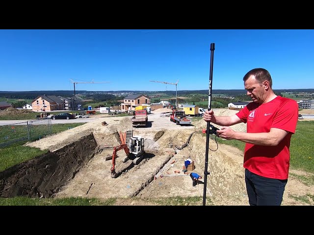
The satellite positioning system GNPS-42 (Global NESTLE Positioning System) is used for RTK real-time positioning to record and stake out points and geometric shapes. The entry-level system, which is quick and easy to learn, offers the usual accuracy of 1 cm in position and 1.8 cm in height.
Thanks to the built-in helix antenna, innovative technologies are used. The simultaneous use of 4 satellite systems (GPS, GLONASS, BEIDOU, GALILEO) enables effortless surveying with the NESTLE GNPS-42. The NESTLE on2go app enables you to work intuitively and without special expertise in the field of surveying.
The complete ready-to-measure system is characterized in particular by its quick readiness for use (switch on and start measurement on2go immediately) and its low weight (1.8 kg). Thanks to the cable connection, no battery is required in the antenna, which makes the complete system very light. All you have to do is charge the tablet battery to power the complete GNPS-42 system.
The system can be assembled in less than 90 seconds: put the pole together, attach the tablet, connect the cables - the system is ready to use.
Quality: Made in Germany.
Usage
RTK satellite survey
construction survey
stakeouts
point shots
Topography, terrain, lines
documentation
planning and monitoring
Lengths, areas and volume measurements
product properties
Antenna / Weight: Helix / 25g
Working height helix antenna: 2 m
GNSS tracking: GPS, Glonass, Galileo, Beidou
Extremely light (1.76 kg as a ready-to-measure complete system)
Accuracy (RTK fixed): Horizontal: 10 mm +1 ppm, Vertical: 18 mm +1 ppm
Operating temperature: -20°C to +50°C
weatherproof
Antenna: cable connection to controller, passive antenna, without any modules
IP protection class: antenna IP67, field computer IP68, sensor box IP54
Power supply: via field computer
Field calculator: Modern 8" Android tablet, pen, outdoor cover, WiFi, Bluetooth, LTE
Battery: Li-ION 4450 mAh, removable
Battery life (system): 6 hours
Charge time: 1.0 hour to 80%, 1.5 hours to full
Field calculator holder: NESTLE H2C-Galaxy Tab2
Rod: 2-part, working height 2 m, internal cable routing, 20' spirit level
Field software: NESTLE On2go App (annual license costs)
scope of delivery
helix antenna
2-piece rod with internal cable routing and bubble level
Field calculator with Li-Ion battery, charger, pen, outdoor cover
GNPS sensor box with connection cable
Holding bracket for field computer and GNPS sensor box
Rod holder H2C for holding beam
Field software NESTLE on2go (one year license)
operation manual
bag
Hints
For the undisturbed reception of the satellite signals, a sufficient "sky view" is required, which means that satellite measurements can only take place outdoors.
In addition to the undisturbed reception of the signals from at least 5 satellites, you also need the data from a correction data service (registration required). The data of this service is sent to your position via WiFi or mobile network and processed in the Nestle on2go software.
In order to be able to achieve the specified accuracy, correction data from a correction data service is mandatory. Extra charges may apply for this service.
The Nestle on2go software is purchased as an annual license. The license for the first year is included with the first delivery.